It is no secret that most of the glaciers in the world are melting. The Olympic Mountains are no exception. In a single generation, one can observe that a good portion of them have simply disappeared from the landscape.
If you have been following the news this year, you would know there is a record setting drought on the peninsula. A light winter and high temperatures, have left the mountains bare of snow during the spring cycle, and to compound the problem, there has been record low rainfall. Now the summer feels like a desert.
I have a small list of places left that I'd like to visit on the peninsula. Most of them are remote, have steep terrain and a lack of maintained trails. Additionally, my goal is to photograph truly wild and remote wilderness places, so I carry a lot of extra weight in camera gear.
We decided to go for this adventure, with only a few days of our trip into the Olympic Mountains. We had the fair weather window for off-trail travel, so it was 'all systems go'. The heat and wildfire smoke would be the most challenging aspects for our trip. Being from the pacific northwest, we are not used to functioning under the dry conditions.
The Queets has long been on top of the list of what it means to be in wilderness. Back in spring, a wildfire started roughly mid-valley. We would need to deal with the smoke from that fire, during this trip.
With heavy packs and energy to burn, we set off upriver in the Quinault drainage.
Warning: Land navigation, map and compass reading skills are required. Previously a trekker could use the Elwha Snow Finger, which is described in the Olympic Mountain Climbers Guide. This is no longer possible because of the lack of permanent snowfields. One must through, up and around the hazards. The melted landscape also leaves the hiker exposed to rock fall; which could be fatal.
Day 5 and 6 was a retreat from the mountains, back into the Quinault rain forest. Overall we were happy to get out of the wildfire smoke. We probably lost a year off of our lives doing this trip, after breathing in such poor air quality, but such is life.
Bonus: Want to see how the glacier looked almost 100 years ago? Check out some photos from the early 1900's.
Update: I walked back a few weeks later, to photograph the area without smoke.
Wrote by Barefoot Jake - updated in 2025
If you have been following the news this year, you would know there is a record setting drought on the peninsula. A light winter and high temperatures, have left the mountains bare of snow during the spring cycle, and to compound the problem, there has been record low rainfall. Now the summer feels like a desert.
I have a small list of places left that I'd like to visit on the peninsula. Most of them are remote, have steep terrain and a lack of maintained trails. Additionally, my goal is to photograph truly wild and remote wilderness places, so I carry a lot of extra weight in camera gear.
We decided to go for this adventure, with only a few days of our trip into the Olympic Mountains. We had the fair weather window for off-trail travel, so it was 'all systems go'. The heat and wildfire smoke would be the most challenging aspects for our trip. Being from the pacific northwest, we are not used to functioning under the dry conditions.
The Queets has long been on top of the list of what it means to be in wilderness. Back in spring, a wildfire started roughly mid-valley. We would need to deal with the smoke from that fire, during this trip.
With heavy packs and energy to burn, we set off upriver in the Quinault drainage.
Warning: Land navigation, map and compass reading skills are required. Previously a trekker could use the Elwha Snow Finger, which is described in the Olympic Mountain Climbers Guide. This is no longer possible because of the lack of permanent snowfields. One must through, up and around the hazards. The melted landscape also leaves the hiker exposed to rock fall; which could be fatal.
 |
| Quinault river under drought |
 |
| Waterfalls off of Mount Queets |
 |
| Navigating away from the dangers in the Elwha Snowless Snow Finger - Burning, eyes,nose and lungs |
 |
| End of day 2 - Recovering from record high temperatures |
 |
| Assessing the route ahead the next day |
 |
| Morning with Mount Seattle |
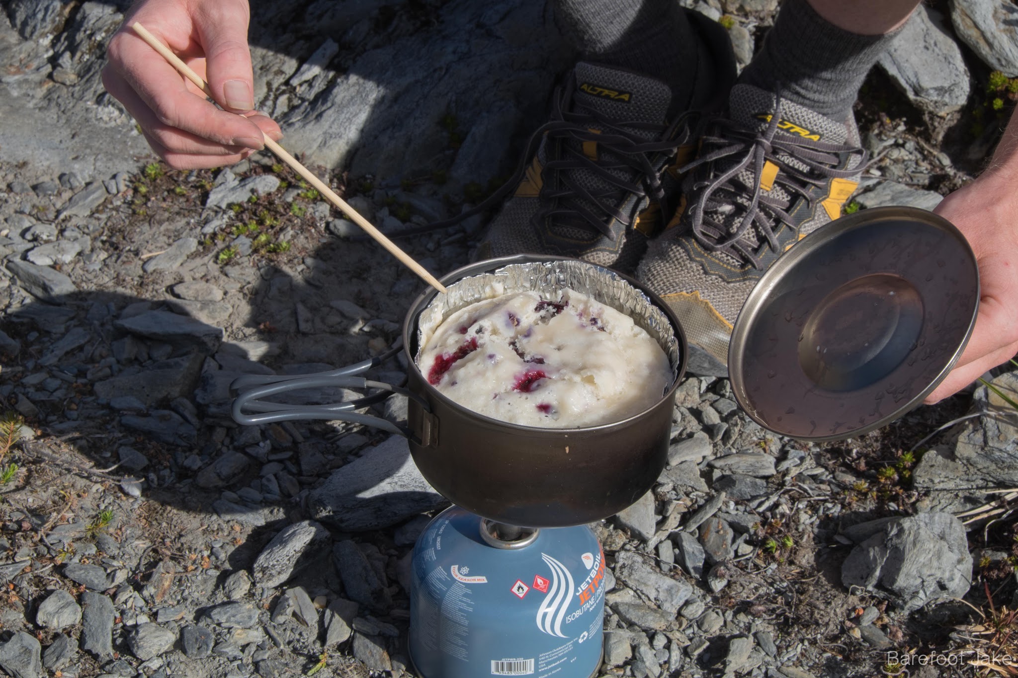 |
| Breakfast muffin with fresh mountain huckleberries |
 |
| After the detour the day before, accessing the remaining Snowless Snow Finger route left for the day |
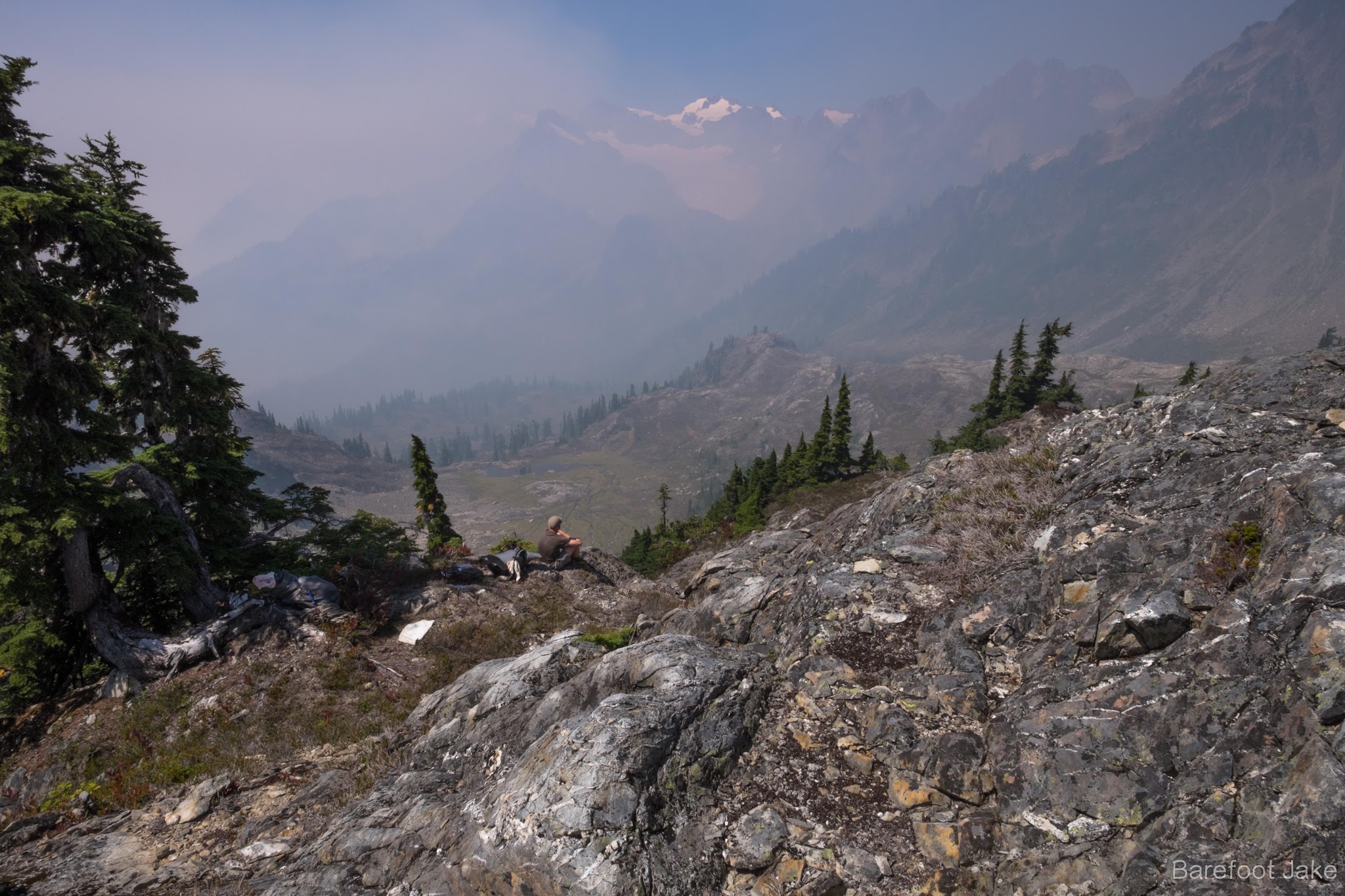 |
| Chose to opt out of staying in the lower basin, because of obvious health concerns; as the afternoon west winds brought smoke inland. |
 |
| Bad air quality fills camp |
 |
| Evening wind blows smoke out of the basin - fresh air was much needed |
 |
| Evening in the Queets |
 |
| Day 4 we went for a walk, deeper into the belly of the beast. |
 |
| Dramatic landscape |
 |
| Queets explorer |
 |
| Afternoon with the Queets Glacier |
 |
| Saying goodnight to the high country |
 |
| Starting day 5 with Mount Queets |
Day 5 and 6 was a retreat from the mountains, back into the Quinault rain forest. Overall we were happy to get out of the wildfire smoke. We probably lost a year off of our lives doing this trip, after breathing in such poor air quality, but such is life.
Bonus: Want to see how the glacier looked almost 100 years ago? Check out some photos from the early 1900's.
Update: I walked back a few weeks later, to photograph the area without smoke.
Wrote by Barefoot Jake - updated in 2025